
Adventure of The Month: Galiano


With our blog having a health focus, especially specific to Tsawwassen, we thought adding hikes of interest would be of value to our community! With that in mind, we decided to write this article (the first of many) highlighting great local hiking trips easily accessible from Tsawwassen. Just a short trip from Tsawwassen by ferry, Galiano Island stands out as one of the easiest hiking destinations from Tsawwassen. It’s particularly convenient since the ferry trip is direct—no stops at other islands required!
Just find your way to the ferry terminal via taxi, Uber, or park at the terminal and walk on. The ferry ride is just under an hour, and when I last checked, it cost $21. Just be sure to check the latest schedule on the BC Ferries website, but you can find a ferry from Tsawwassen in the morning, return trip in the afternoon most days, if not every day!
In this article, I’ll be covering three different hikes: Lookout Trail in Bluffs Park, Mt. Galiano, and Bodega Ridge. I’ll discuss them by their distance from the ferry terminal.
You can actually reach both Bluffs Park and Mt. Galiano on foot from the ferry terminal, but be aware you’ll be adding some extra distance to your journey:
- Bluffs Park adds about 2.9 km each way from the ferry terminal to the trailhead.
- Mt. Galiano adds about 4.3 km each way from the ferry terminal to the trailhead.
If all that extra walking doesn’t appeal to you, you’ll definitely want to bring a car or a bike.
Hike #1 – Bluffs Park
If you’re driving, get to the parking area by turning left onto Burrill Road from the ferry terminal, then taking a right onto Bluffs Road. Follow Bluffs Road until you see the parking lot on your left.
From the parking lot, you have two main trail options:
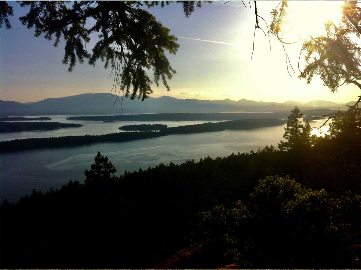
- The Bluff Trail (Lookout Trail): If you just do the most scenic section along the bluffs, it’s a short 1.4 km (700 meters each way). Although short, it’s a stunning trail with beautiful grassy meadows that give you great views down to Active Pass and Mayne Island. You can also do the entire, longer loop Alltrails Bluffs Park Trail.
- Ridge Trail: To extend your journey, enjoy the other trail leaving from the same parking lot, which explores the Matthews Point Regional Park Reserve. On Alltrails, this one is called “Matthews Point Ridge and Beach Trail” Alltrails Matthews Point.
If you combine the best part of the Bluff Trail and the Matthews Point Ridge, you’ll do about 5 km of very scenic hiking. This makes for a nice, easy 1.5- to 2.5- hour trip, depending on your pace and how many breaks you take to enjoy the scenery.
Hike #2 – Mt. Galiano
If you’re driving to the parking area, take Sturdies Bay Road past the Hummingbird Pub, turn left onto Georgeson Bay Road, and continue until you can turn right onto Active Pass Drive. The parking area will be on your right.
This is a steep climb, gaining just under 300 meters over 2.9 km (Alltrails Mount Galiano). The trail is mostly on a road, and to be honest, the hike itself isn’t terribly scenic until you hit the summit. However, the views from the top are absolutely fantastic! It’s well worth the effort—we highly recommend bringing a picnic to spread out and enjoy the view while basking in the sun (if you’re lucky with the weather).
All Trails also suggests continuing down the other side of the mountain to make a loop, which adds about another 1 km to your total journey (Alltrails Mount Galiano Loop). If you try out this loop, please let me know how it looks or leave some information in the comments section as we haven’t done this one yet.
Hike #3 – Bodega Ridge Trail
This trail is located further up the island, so you’ll definitely need a car or maybe a long bike ride (E-bike anyone?) to access it. The trailhead is 19 km from the ferry terminal—about a 25-minute drive.
It’s been several years since I last did this trail back in 2014, but I remember it being very beautiful almost the entire way. The route takes you through mature forest that eventually opens up into stunning arbutus trees and dry desert-type shrubs as you gain the ridge. From the top, you get an amazing view of the islands in the Trincomali Channel, spreading out towards Saltspring Island. The whole hike is about 8.4 km long with a 250-meter elevation gain (Alltrails Bodega Ridge).
Side Trips
If you have time, be sure to stop at Montague Harbour Provincial Park to explore and swim. They have a stunning white sand beach. It’s also a great place to camp if you’re lucky enough to snag a camping reservation. It’s popular, so if you want to stay overnight and camp you’ll likely need to book at least a few months in advance. https://camping.bcparks.ca/
